Marais Salants de l’île de Ré
Name
Marais Salants de l'île de Ré
Location
The salt pans of the island of Ré (46 ° 13 'N, 01 ° 27' W) are located north of the island of Ré and cover the territory of five communes: Les Portes en Ré, Saint Clément des baleines, Ars en Ré La Couarde sur mer and Loix.
Description
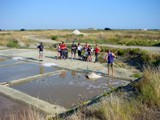
The salt pans cover an area of 1,560 ha, i.e. 18% of the island of Ré, the water surface is 1070 ha, ranging between productive and unproductive areas. The salt pans were built on land reclaimed from the sea by means of dams, called prises.
Currently, 460 ha are still exploited through artisanal sea salt production. The other salt pans were adapted for oyster farming and aquaculture (243 ha), for the preservation of nature - Réserve Naturelle de l'au Illeau Niges, reserves of biotypes - (80 ha), or even for hunting or recreational aquaculture (136 ha). A large part of the salt marshes is still unexplored.
The site of the salt works of the island of Ré is part of the RAMSAR list.
The salt works of the island of Ré are part of Natura 2000 network (Nomenclature Natura 2000: 1140, 1210, 1310, 1320.1330, 1420, 2190, 1410, 6510).
Most common types of use
There are two main modes of exploitation of the salt works: salt extraction and oyster farming.
Table 1 - Surface occupied according to the different uses.
|
Salt marshes |
Occupied surface (m2) 2009 |
|---|---|
|
Salt extraction |
460 000 |
|
Oyster farming |
250 000 |
|
Intensive fish farming |
50 000 |
|
Extensive acquaculture |
40 000 |
|
Natural use |
80 000 |
|
Sporting or recreational uses |
150 000 |
|
Other uses (irrigation reserve, impoundments) |
50 000 |
|
No use |
500 000 |
Socio-economic characteristics
Annual production is 2,500 tons, on average. One hundred farms produce sea salt and fleur de sel between 15 June and 30 September.
In 2009, one of a hundred salt pans producing sea salt by means of traditional methods is managed by one of the partners of the ECOSAL Atlantis Project:
- The Marais Salant de la Prise de la Lasse is owned by the Conservatoire du Littoral and houses the sea salt ecomuseum, which, besides studying salt production, aims to provide the public with knowledge of salt production and the interpretation of the region. Its purpose, apart from artisanal salt production, is to make the practice of salt production known for educational, cultural and environmental reasons.

